 |
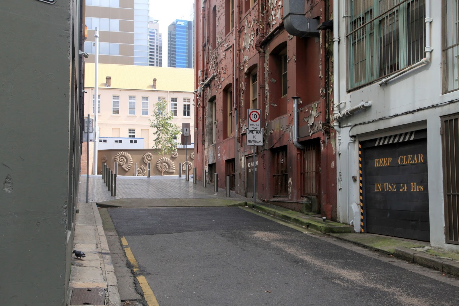
| Yurong Lane ome back south of William Street. Looking toard the old National School which is now part of The Australian Museum. |
| As Sydney developed, the original topography was totally altered, both by pick’n’shovel and by bull-dozer. The pressure of a burgeoning population turned pristine streams, into open sewers, into closed sewers, into redundant infrastructure. It happened to the Tank Stream, and the Yurong Stream is another such casualty in the development of the inner city. As a result of a conversation on FB with Wooloomooloo Insider, I challenged myself to find out about a bridge over William Street, still there, that I did not even know existed. |
 |  |
| Images taken in June 1916 in preparation for the demolition of th south side of William Street, to allow for its widening from 41 feet to 100 feet. The image on the left is facing west (you can see the National School). The image on the right is facing east. Note the structure about centre of each image which is white, where the man is squatting. This is 59 Yurong Lane. |
| William Street is a major thoroughfare east from the city. It was created between 1836 and 1840, by convict labour. It crossed the Wooloomooloo Valley and progressed up the Darlinghurst escarpment. Not where the Surveyor-General (Sir Thomas Mitchell) had planned, but further north where it did not slice through the estate of Sir Alexander Macleay who, as Colonial Secretary, was further up the civil service ladder than Mitchell. All this was very self-serving, as civil servants were the most to benefit by pushing through this road. It meant they no longer had to take the long way via Oxford Street and Darlinghurst Road to access their vast estates. But the real import of pushing William Street through, was that it opened up the valley for settlement by the hoi-pol-oi. |
 |  |
| The map shows the Yurong Stream, beside Stream St, from Stanley Street on the right to beneath 59 William St on the left. The image shows Stream St today. |
| Much of the topography of the inner city has been obliterated by landscaping: by the lopping of hills, and filling of valleys. However, the stream that William Street had to cross, can still be traced using skerricks of visual clues. I walked the old water course last week, my head filled with equal doses of maps and scepticism The map (above) shows a late 19th century view of Stream street, as it meanders beside the Yurong Stream. The image beside the map shows what it was like last week. Yes, it is very inner-city, two-parts shambolic, and 3 parts run-down. But, look at the LHS of the map where Stream St ceases, but the Yurong Stream continues on beneath the built environment and under William Street. See the representation of the Arch? |
 |  |
| The buildings in these two images stand above the Yurong Stream as it flowed beneath William Street. The image on the left is the north-side of the street which was not altered as a result of the widening. The right-hand image shows the LHS of William St which was extensively altered. The shape of the William St Arch is drawn on the map. Embiggen, and see. |
| The widening of William Street as a result of the 1909 Royal Commission, did not toll the death-knell of the Yurong Stream, as it was already dead and buried, literally. The pressure of population had managed this from 1837 to about 1857. As people are want, the open stream carried away all their effluent and household detritus. It was not just the Yurong Stream that suffered this fate, from stream to buried sewer, but also the Tank Stream, the Hay St sewer into Darling Harbour, the Wattle St sewer into Blackwattle Bay, and the Fort Macquarie sewer into the harbour adjacent to the current site of the opera house. It is interesting to note that 59 William Street in 1916 (RH image, behind the large hoarding splattered with advertisements) was a set of horse-stables leased to Arthur Travers. My guess is that this required very little disturbance of the substructure. This is the "front" entrance, whereas the "rear" entrance I showed you in the Yuromg Lane images at the get-go of this post. |
 |
| By 1875, "t Woolloomooloo Bay a large bank had formed and sewage floated on the surface of the salt water, oscillating back and forth with the movement of the tides." Beder (1990). |
| In the period from 1855 to 1875, virtually all of Sydney’s sewage discharged into Sydney Harbour via the sewers built in the 1850s and 1860s. Pasteur’s work on the origins of disease was not published until 1878. The outbreaks of disease in Sydney in 1857 and again in 1875, mirrored the miasmic outbreaks in Cornwall and Lambeth in Greater London in the 1840s and 1850s. Between 1857 and the 1880s open “flowing” streams and creeks were enclosed, whilst still combining sewage AND stormwater. It was not until the advent of the Water Board (under its various names) that the effluent from this burgeoning city was diverted into the ocean, the Wooloomooloo Sewer being diverted to the Bondi Ocean Outfall System (BOOS). |
 |
| This is the current day intersection Of Cathedral Street/St Mary's Rd and Riley St and the Yurong Parkway/ Sir John Young Crescent. This is very close to where the putrid mudflats of Wooloomooloo Bay sloshed. This 1854 map show that this is where the Yurong Stream met a smaller but probably more swift stream, that ran down the slopes from close to the present site of St Mary's Cathedral, about the line taken by the Yurong Water Feature. The main line of the Yurong Stream started as a fork adjacent to the penitentiary, and meandered down, crossing both Liverpool and Stanley Strees, gouging out the route for Stream St, going UNDER 59 William St AND 70B William St, along the wriggle of Busby's Lne, and hence into the bay about where this image shows nowadays. |
 |
| Sydney from Wooloomooloo (1849) George Lambert |
| Which, in my opinion, puts a lie to this bucolic scene. The topography looks fairly accurate to me, and the 1849 date od the representation, means that the stream was stiull open, even though leaning toward sewer rather than pristine scene. William Street is on the extreme LHS, and St Mary's eventually gets totally swung around after its rebuild. I know there were swimming baths in Wooloomooloo Bay, but is is difficult to understand that these baths could have been prior to the 1880s cleanup of the effluent. However, little was know about the effects upon public health until about this time, and poerhaps swimmers did not realise that these conditions gave rise to typhoid. |
 |
| And here is an image of the William Street Arch, now home to the indie group, “Underbelly Arts”. The image I found in the 2014 brochure for the Historic Houses, ”Sydney Open”. One can see the pipe through which the stream/effluent charged. This is surrounded by the southern wasll which would have been parallel to William St. In front of us, at right angles to this southern wall, is the stone-faced embankment of the infrastructure. I am reticent to claim it as the 1837 version of the “bridge”. It could be the 1857 upgraded facility for the Wooloomooloo Sewer. |
| REFERENCES Woolcott & Clarke's 1854 Map of Sydney & Suburbs Sydney's Water, Sewerage and Drainage Ststem, Donal Hector (2011) The Water Supply and Sewerage of Sydney, F.J.J. Henry 1939 Sydney Local Environmental Plan 2012 City of Sydney Photographic Archives Early Environmentalists and the Battle Against Sewers in Sydney, Sharon Beder (1990) Faces of the Street - William Street Sydney 1916, Max Kelly, 1982 State Library Of NSW Dictionary Of Sydney |
3 comments:
Lots of great history here. I always enjoy reading your well researched historical posts Julie.
My pleasure, Jim. I get immense pleasure out of the "hunt".
Great piece of work! Barby Woolloomooloo Insider
Post a Comment